Your photos know where they were taken. Let AI find out.
Trying to fix missing GPS metadata in your existing photo library? Most travel and documentary shots lack coordinates but still carry location cues in every pixel. Photoreka's AI engine inspects your untagged photos, reads visual context (architecture, signage, landscapes, lighting), and places them on the map with city or district-level precision. It is AI geotagging for DSLR and archive libraries that were shot without GPS.
This workflow is built for your own catalog inside Photoreka, not for OSINT-style investigation of third-party photos.
A geolocatability forecast shows you the expected success rate before you spend a single credit. Only confident matches land on your map.
Who needs to recover missing GPS metadata
Whether you've been shooting for years without GPS or just want to fill in the blanks in your archive — geo-inference puts your story on the map.
Travel Photographers
Shot thousands of frames across a dozen countries before GPS was standard? Geo-inference reads landmarks, architecture, and signage to recover the geography your old camera never stored.
Documentary & Street
Urban environments, street signs, and architectural details are rich visual cues. Wide-frame, well-lit outdoor shots achieve the highest inference accuracy — exactly the kind street and documentary work produces.
Nature & Landscape
Distinctive terrain, flora, and lighting conditions often reveal region or country. Outdoor shots in natural light are the strongest candidates for successful geolocation.
Archive Researchers
Working with digitized film archives or inherited photo collections with no metadata? AI geo-inference provides a first-pass geographic classification for large, untagged batches.
How geo-inference works
From opening the map to AI geotagging your photos — four steps and you're done, even if it takes a while to process.
Open the World Map
Navigate to the World Map in the Photoreka web platform. Your photos with real GPS coordinates are already plotted. Photos without location data are counted and ready for analysis.
Review the geolocatability forecast
Before committing any credits, the AI scores each photo across genre, lighting, framing, focus, depth of field, and palette. A three-tier forecast (Good / Possible / Unlikely) shows you how many photos are worth analyzing — so you can decide whether to proceed.
Start inference in the background
Click Start Inference. Photoreka sends each photo to a vision AI that reads visual context, infers the most likely city or region, and filters out low-confidence guesses. You can close the dialog — processing continues in the background and you'll receive an email when the map is updated.
Explore, filter, and correct
New markers appear on the map with a distinct glow. Filter by inference confidence, granularity (place / city / region / country), or visual aspects. Any marker can be manually corrected — click the edit button, drag the pin to the exact location, and your correction is permanently stored.
No Photoreka account? Try Geo Recovery
If you just need a one-time geolocation service without a full Photoreka account, Geo Recovery is the perfect solution. Upload any batch of photos, pay once, and download your originals with GPS coordinates embedded directly in the EXIF. No sign-up required, no subscription, no strings attached.
Built for accuracy, designed for trust
Not every photo can be geolocated or geotagged — and we tell you that upfront. Every design decision prioritises reliability over recall.
Geolocatability Forecast
Before you spend any credits, a heuristic scoring algorithm evaluates each photo's genre, lighting, framing, palette and focus. The three-tier forecast (Good / Possible / Unlikely) sets honest expectations and warns you if your batch has low success potential. Ideal before you start geotagging a large archive.
Confidence Gating
Only high-confidence inferences land on the map. Photos where the AI cannot identify a reliable location are explicitly marked as unknown — they never produce phantom pins that mislead you.
City or District Precision
Results are delivered at city or district level — realistic and useful for archiving and storytelling. The system doesn't guess street-level coordinates it can't support, but accurately places your photo in the right metropolitan area.
Background Processing
Large batches can take time. Once you start an inference job you can close the dialog, navigate elsewhere, or close the browser entirely. Photoreka processes in the background and emails you when the map update is ready.
Manual Correction
Every AI-inferred marker displays a pencil button. Click it to open a correction panel, adjust the coordinates (city or precise pin), and save. Your correction replaces the AI result permanently — you always have the final word.
Rich Map Filtering
Filter your map markers by GPS source (real GPS, AI-inferred, or manually corrected), confidence level, geographic granularity, or any combination of visual aspects (genre, lighting, framing…). Explore your archive the way you want to.
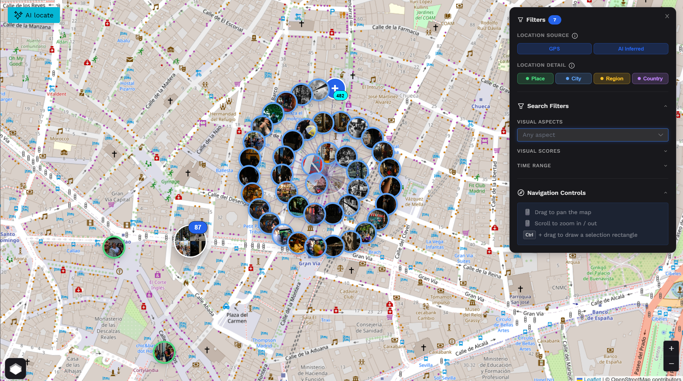
Every photo. Every location. One map.
Once geo-inference completes, your photos appear as clustered, geotagged markers on a full-screen interactive map. Click any cluster to explore what was shot there. Filter by GPS confidence, AI inference quality, or granularity (city, region, country). Correct any misplaced photo directly from its marker — manual precision always wins over AI.
Frequently Asked Questions
Everything you need to know about AI geo-inference
Your archive holds more geography than you think.
Stop guessing where your photos were taken. Let Photoreka's AI read the visual evidence and put them on the map — city by city, memory by memory.
Want to explore your photos visually? See 3D Atlas · Build a Portfolio · Geotag photos with AI