Your photo vocabulary mapped in 2D space
Thousands of tags from your photos—people, places, moods, objects, weather—arranged by semantic similarity in an interactive map. Tags that share meaning cluster together.
Pan, zoom, select, and search by navigating. The closer two tags are, the more often they appear together in the same kind of scene.
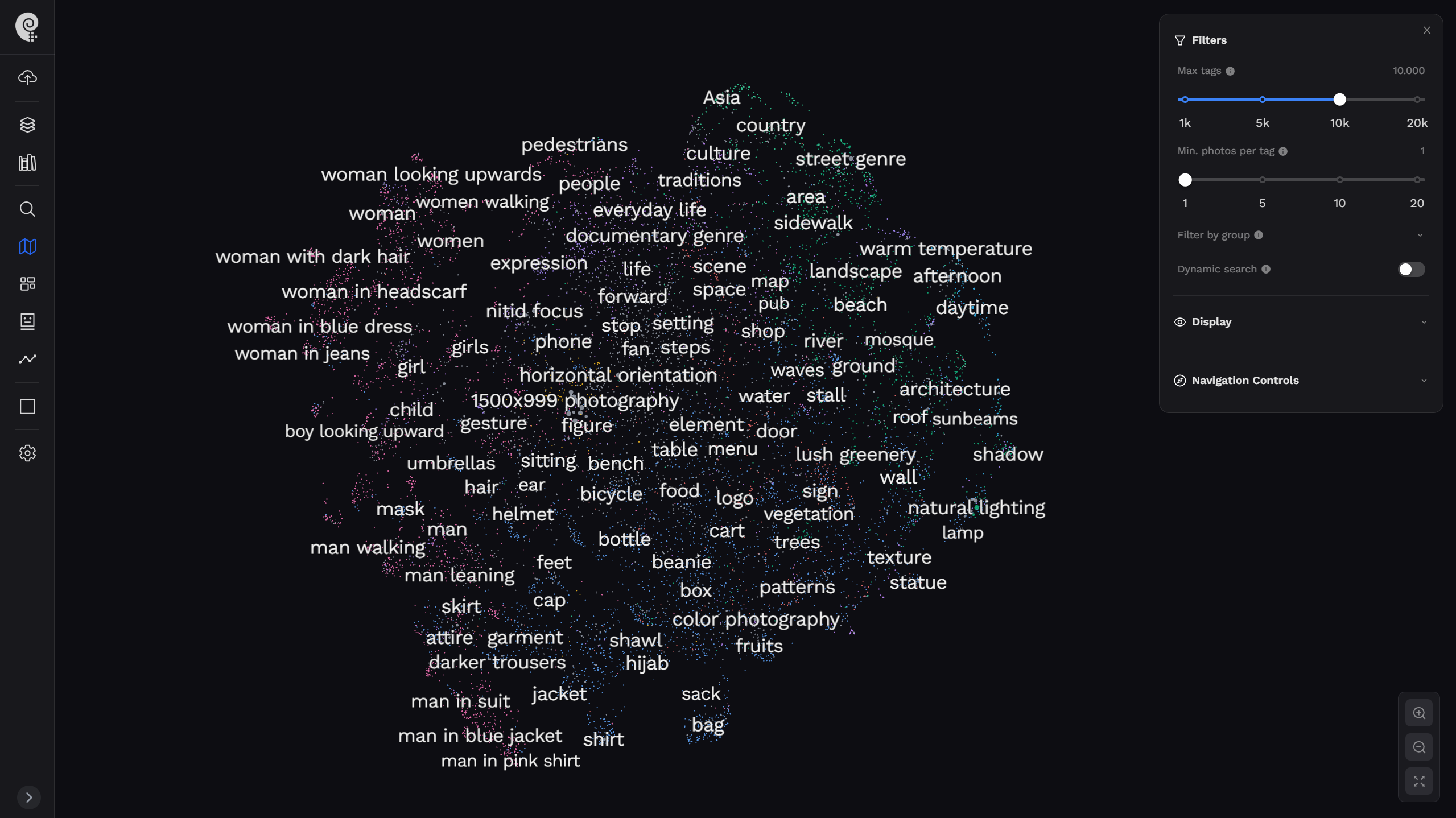
Every tag, color-coded by category
AI assigns each tag to a semantic group. The color palette instantly tells you what type of concept you're looking at—and you can filter the map to focus on just the groups that matter to you.
From photos to a living map
The tag cloud is built automatically from AI analysis of your photos. No manual tagging—ever.
AI analyzes every photo
Photoreka runs each image through a computer vision model that extracts dozens of semantic tags per photo: subjects, moods, settings, lighting, abstract themes, and cultural references.
Tags are embedded in semantic space
Each unique tag is converted into a high-dimensional semantic vector. Tags with similar meaning—or that tend to co-occur in similar scenes—end up geometrically close in this space.
Dimensionality reduction maps them to 2D
UMAP reduces the high-dimensional embedding to two coordinates, preserving local neighborhood structure. The result is a 2D plane where clusters are semantically meaningful—not random.
PixiJS renders the interactive map
All tags are drawn with WebGL via PixiJS. Labels appear dynamically as you zoom in, collision-aware so they never overlap. Dot size reflects how many photos carry that tag.
Navigate and search
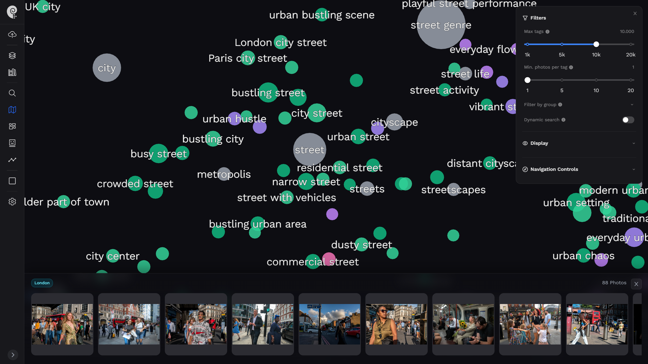
Click a tag to find all photos with it. Drag a rectangle to combine multiple tags. Enable dynamic search and the visible area becomes a live query—the map IS the search interface.
More than a word cloud
Position carries meaning. The Tag Cloud is a navigable semantic space where exploration is search.
Semantic positioning
Tags are placed by meaning, not alphabetically or by frequency. "Rain" and "fog" live next to "melancholy" and "mist"—because that's how they relate in real photographs.
10 color-coded groups
At a glance, you see which area of the map is about people, which is about place, which is about weather. Filter to a single group and the map instantly focuses.
Balloon expansion
Dense clusters can be expanded with a slider, spreading tags apart so you can read and interact with previously overlapping labels without losing their relative positions.
Rectangle multi-select
Hold Ctrl (or Cmd) and drag a selection rectangle over any area of the map. All tags inside are combined into a single AND/OR query against your photo catalog.
Collision-aware labels
Labels only appear when there's room to show them without overlapping. As you zoom in, more labels become visible—dense areas reveal their detail progressively.
Dynamic search mode
Toggle dynamic search and the Tag Cloud becomes a live photo browser. The most visible tags on screen are automatically used as a query—real-time results with every pan.
Pan into a cluster, instantly see those photos
Enable dynamic search and the Tag Cloud becomes a spatial photo browser. As you zoom and pan, Photoreka automatically queries your catalog with the most visible tags and streams the results—no button needed. Arrive in the "melancholy urban" cluster and your best matching photos appear instantly.
- Spatial browsing: move the map, change the results
- Rectangle selection to hand-pick any tag combination
- Filter by group to focus on mood, place, or subject
- Works across catalogs of 100,000+ photos in real time
Frequently Asked Questions
Everything you need to know about the Tag Cloud
Your catalog has a shape. Discover it.
Every photo you've ever taken adds a point to your personal semantic universe. Analyze your library and see the full map for the first time.
Want to see your photos in 3D space? Explore the 3D Atlas